FAQs about Bolaven as of 8 p.m., Monday, October 9, 2023
Q: What conditions are Guam and the CNMI in?
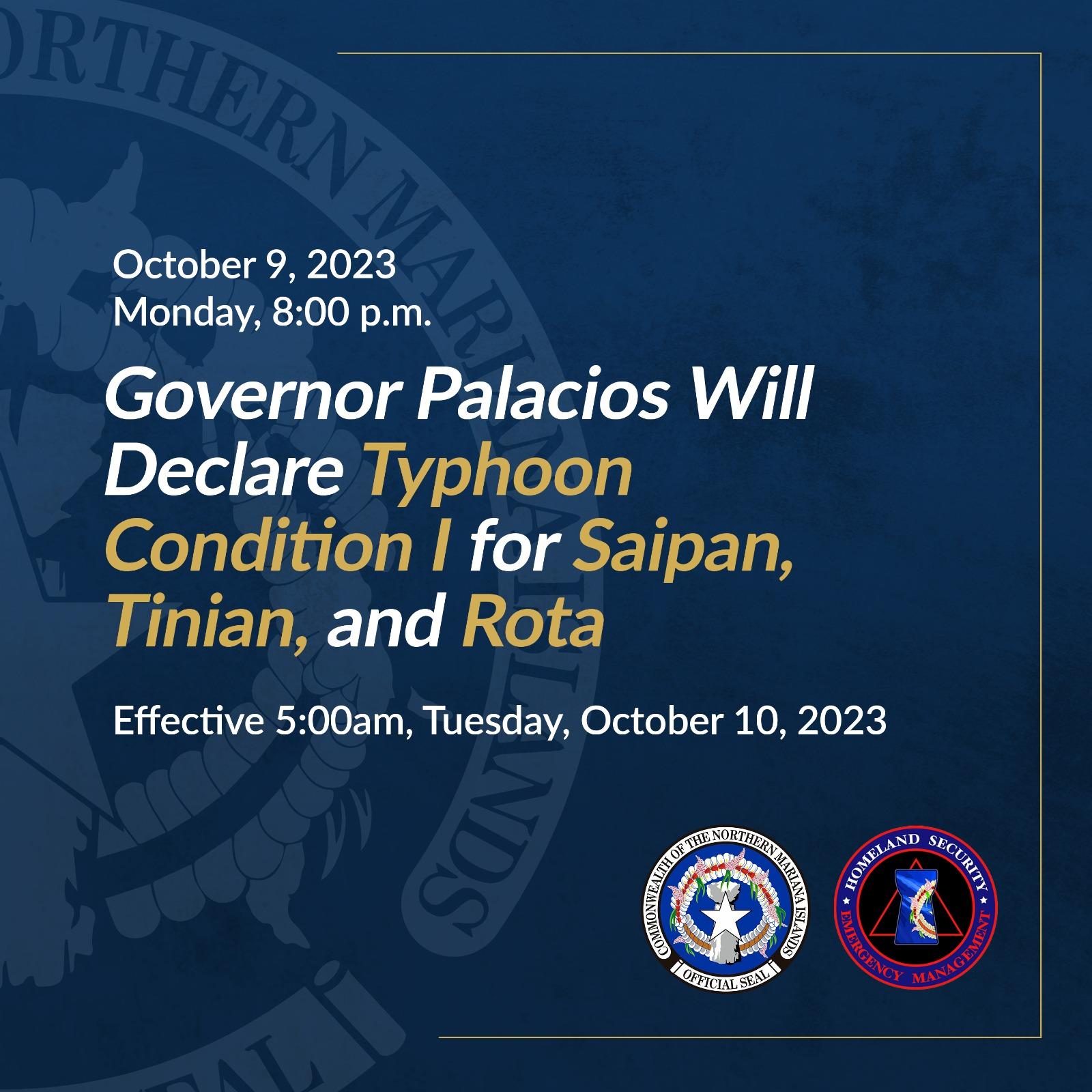
A: CNMI Governor Arnold Palacios’ office tonight announced that at 5 a.m. tomorrow, Tuesday, October 10, 2023, all three islands will be in Typhoon Condition 1. Guam will be in Condition of Readiness 1 at 10 p.m. tonight, Monday, October 9, 2023; that is an upgrade from COR2.
——
Q: Why are the islands in different conditions?
A: First of all, the four islands are geographically separate, with Guam and Rota close to each other, and Tinian and Saipan close to each other. Secondly, Guam and the CNMI use two different systems of readiness. Guam uses what’s called ‘Conditions of Readiness,’ or ‘COR’ and they go through levels 4 through 1, with 4 being normal conditions, and 1 signaling the onset of some type of storm. In the CNMI, the term “Typhoon Condition” is used, and it also ranges from 4 to 1, with 4 being normal. There’s a big difference, though, aside from the names.
The Guam COR system is indifferent to whether a tropical storm or a typhoon is coming. As long as damaging winds (maximum sustained winds of 39 mph or greater) are expected within a certain time frame, a certain COR will be called. If damaging winds are possible within 48 hours, then the Guam governor will call COR3. If damaging winds are expected within 24 hours, then she will call COR2. And if damaging winds are expected within 12 hours or already are occurring, Guam will be in COR1.
The CNMI Typhoon Condition system signals when typhoon-strength activity may happen. At Typhoon Condition 3, a typhoon is possible within 48 hours. At Typhoon Condition 2, typhoon-strength winds are anticipated within 24 hours. At Typhoon Condition 1, typhoon-strength winds are anticipated within 12 hours, or already are occurring in whichever island or islands of the CNMI are affected.
——-
Q: Is Bolaven going to hit Guam, Rota, Tinian, or Saipan?
A: The storm – which as of right now is a tropical storm – is about 24 hours away (give or take a few hours) from being at its closest point to somewhere in the Mariana Islands. That kind of time still allows the storm to shift north or south. That shift can affect which island gets a direct hit, or whether the strongest part of the storm (the center) could travel through the waters between the islands. As of now, the storm appears to be on a course that will take it north of Rota. As the hours go by, the possibility that the storm will pose a direct threat to Guam are dwindling. HOWEVER: All the islands of the Marianas are in danger of receiving damaging winds and heavy rains.
——-
Q: How strong will Bolaven be when it gets to wherever it’s going in the Marianas?
A: The current forecast shows Bolaven will be either a category-1 or a category-2 typhoon by the time it makes its closest point of approach to the Mariana Islands. HOWEVER: Bolaven can be stronger, if the storm undergoes what’s called rapid intensification. It’s exactly what it sounds like—the storm will rapidly intensify in wind strength. This is why it is so important to continue listening to and reading updates on Bolaven’s development. And to prepare for a typhoon.