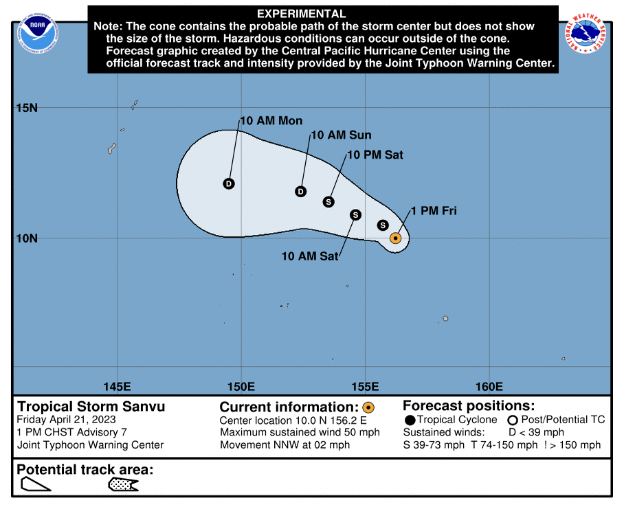
The National Weather Service (NWS) Guam Weather Forecast Office continues to monitor Tropical Storm Sanvu. As of 1 p.m., Sanvu was located 10.1 degrees north latitude and 156.1 degrees east longitude, 345 miles east-northeast of Chuuk, 780 miles east-southeast of Saipan, and 800 miles east-southeast of Guam, moving north-northwest at 2 mph, with maximum sustained winds of 50 mph.
Although tropical storm force winds are not forecast for the Marianas at this time, there is potential for increased winds and rain as early as Monday night, into Tuesday next week. While Sanvu was expected to weaken in the short-term, it has slowed considerably in its forward motion, giving it more time to organize. Because of this, the community is advised to:
· Stay up to date with the latest information through the weekend;
· Be prepared to take action, if warranted, if the potential for heavy winds and rains increases;
· Be alert for potential advisories for hazardous seas and small craft