Tropical Storm Bolaven is expected to become a typhoon over the next few hours as it makes a path that – as of 8:30 a.m., Tuesday, October 10 – will bring the center and strongest portion of the storm through the waters between Rota and Tinian. Any deviation north or south of that path can mean a direct hit for any one of the islands of the CNMI.
“Guam is out of the crosshairs of direct passage,” National Weather Service Guam office chief meteorologist Landon Aydlett said at his 8:30 a.m. public briefing.
Though Guam almost certainly will not see direct passage of Bolaven, it still likely will receive damaging winds.
Here is a projected timeline of Bolaven’s path through the Mariana Islands, forecasted as of 8:30 a.m. today:
10 a.m.: Rota will begin to feel tropical storm-force (damaging) winds.
11 a.m.: Rota and some parts of Tinian and Saipan will feel tropical storm-force winds.
Noon: Tropical storm-force winds will envelop the CNMI’s three major islands and some of Guam.
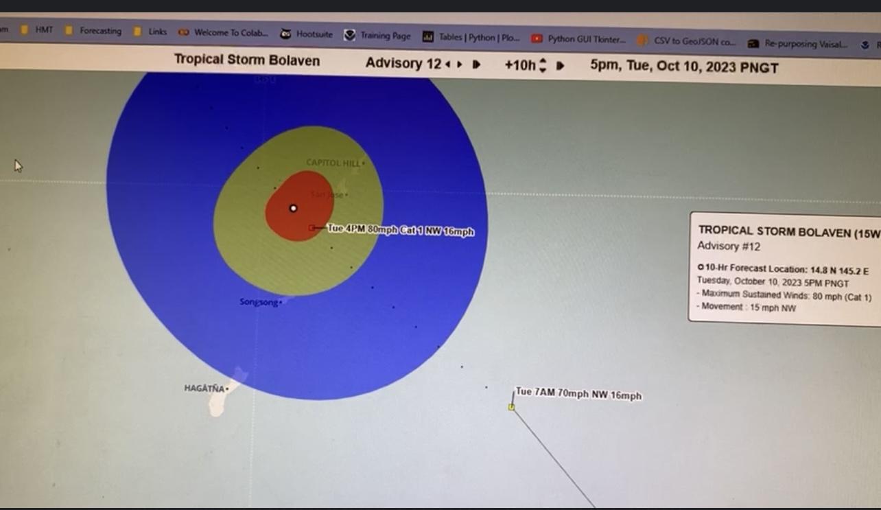
4 p.m: Bolaven makes its closest point of approach to the Mariana Islands, with the possibility of typhoon-strength winds reaching Rota, Tinian, Saipan, or all three of the islands.
The northern part of Guam is expected to be covered by the outer part of the soon-to-be typhoon, which will carry damaging (tropical storm-force) winds.
“Guam is halfway in and halfway out,” meteorologist Brandon Aydlett said at the briefing. “Those in southern Guam, you’re going to have minimal effects.”
Brandon Aydlett said any wobble in the storm is important to watch, as it could be the difference between a direct passage over Rota or Tinian-Saipan.
“Will this be a Rota graze, or a Saipan-Tinian graze?” Brandon Aydlett posed. “This is what we have to watch out for.”