The Joint Typhoon Warning Center last night upgraded Invest 98W’s likelihood of developing into a significant tropical cyclone within 24 hours to “high.”
Moments ago, the National Weather Service issued the following update:
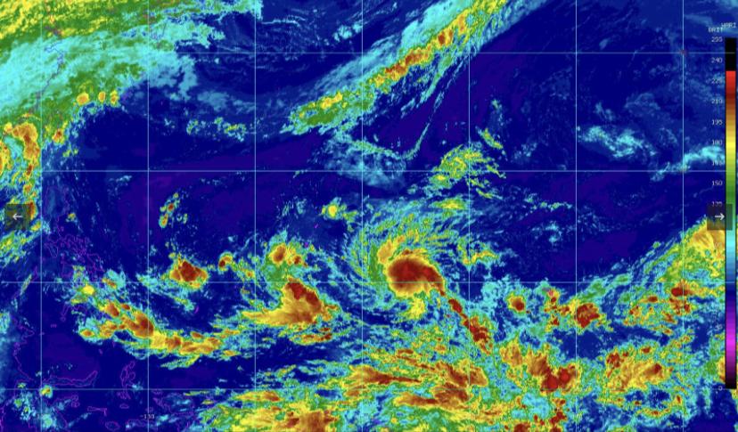
A developing tropical disturbance, known as Invest 98W from the Joint Typhoon Warning Center will approach and likely pass through the Marianas Tuesday night or Wednesday (as it stands right now).
This is a developing situation, but the forecast “cone” is starting to narrow, with a potential passage between very near or through the Mariana Islands. IT`S IMPORTANT TO NOTE, forecast variability continues and later forecasts will likely change.
What`s important to note is the trends in the data over the last 24 to 36 hours there have been an upward trend in projected strength, indicating potentially higher sustained winds speeds have been observed. That said, it`s still to early to specify what wind speeds will it be as it passes through the region.
What is of more certainty is heavy rainfall and higher seas will accompany this feature. Current estimates are for 6 to 10 inches of rain will fall between Monday afternoon and Wednesday afternoon, with locally higher amounts near 12 inches possible. Seas will also build into the 14 to 18 foot range, possibly higher.
——-
Kandit will live stream an update from the Emergency Operations Center at the Guam Office of Civil Defense at 3 p.m. today (Saturday, October 7, 2023). Stay tuned for the latest.