
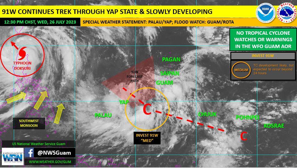
A tropical disturbance, Invest 91W, already southwest of Guam is causing rainier days in the Marianas, but it’s a “monsoon trough stretched across Micronesia to the south,” that will keep weather experts fixed to satellites and screens the next two weeks.
And we all should be paying attention to what they say during this period.
“Folks should keep up to date on all weather forecasts during this period of wetter weather,” Landon Aydlett, National Weather Service Guam’s chief meteorologist said.
As of now, a typhoon is well west of Guam, having passed slightly north of the Philippines earlier today, and Invest 91W is closer to the realm of Yap and Palau, southwest of Guam. A band of clouds and weather activity, however, stretch all the way east to the Marshalls.
“Long range models are flirting with several different potential tropical systems for next week, but all generally are in the Philippine sea and still in the broader realm of speculation for now,” Mr. Aydlett said.
Tropical cyclones that are a concern to Guam and the CNMI generally form to the southeast, starting near Chuuk or in the vicinity of the Republic of the Marshall Islands.
“We are in an active period of activity now for a couple weeks with the monsoon trough stretched across Micronesia to the south,” Mr. Aydlett said. “During this period, we can expect to see several disturbances in the region; some may develop into something of a bigger concern next week – but timing and location are key.”
Mr. Aydlett will be Kandit’s guest-in-studio during our 10 a.m. Friday news talk show. The show features at 10 a.m. every week day and is published live on both our Facebook and YouTube platforms.


1 Comments
Pamela Duvall
07/27/2023 at 7:13 AM
Thank you for keeping us informed 👍🏼